10 Advanced Satellites Changing How We Remotely Observe Earth

Hey there! Ever wondered how we capture those stunning images of Earth from space? Let’s meet the satellites that make it all possible. They keep an eye on storms, monitor deforestation, and are revolutionizing our ability to observe the planet remotely. So, look up at the 15 most exciting eyes in the sky orbiting our planet right now.
Landsat 9

This satellite is operated by one of the longest-running Earth observation programs. It provides highly detailed imagery that helps track changes in forests, cities, and agricultural lands over time. By capturing every scene with clarity, Landsat 9 is a trusted resource for scientists studying climate change, urban growth, and ecosystem shifts
Aqua

Partnering with Terra, Aqua specializes in water-related data, studying oceans, rivers, clouds, and even air vapor. The satellite plays a significant role in climate studies, tracking global precipitation patterns and ocean temperatures. This information helps researchers forecast weather patterns, understand droughts, and explore water-related climate impacts.
ICESat-2

An orbital platform focusing on Earth’s ice sheets, glaciers, and sea ice—Its laser altimeter accurately measures ice thickness, providing critical data on polar ice loss. ICESat-2 collects data on changes in the ice cover, which is essential in assessing the rate of polar ice loss and predicting the potential rise of sea level.
GOES-R Series

This isn’t just one satellite but a set that provides real-time weather updates across the Americas. With super-fast image updates every few minutes, this series of orbital sensor suites is a lifesaver during hurricanes and wildfires. They closely monitor severe weather, helping meteorologists make faster and more accurate predictions.
Suomi NPP

Using a fine-toothed-comb approach, the Suomi NPP combines weather, oceans, and land data to broaden our understanding of climate. From spotting nighttime lights to mapping snow, it captures unique details to study environmental changes. Its infrared and visible sensors cooperate to give a day-and-night perspective on everything from vegetation health to temperature shifts.
Jason-3

Tracking sea level changes requires the utmost precision, which Jason-3 effortlessly achieves. Observing ocean currents, tides, and wave heights helps scientists study global climate patterns. Jason-3’s ocean measurements are essential for predicting how climate change is impacting coastal communities around the world.
Copernicus Sentinel-2
This earth observation wonder’s multispectral imaging is ideal for detailed studies of vegetation, soil, and coastal areas. Copernicus Sentinel-2’s data is used in agriculture to assess crop health and in forestry to monitor deforestation. With vibrant, clear images, Sentinel-2 enables researchers to keep tabs on Earth’s natural resources, helping manage them sustainably.
Sentinel-5P (ESA)

Launched in 2017, Sentinel-5P tracks air quality by measuring gases like nitrogen dioxide, carbon monoxide, and ozone. Its TROPOMI instrument provides detailed atmospheric data, which is essential for understanding pollution sources, studying climate change, and forecasting air quality. The data also inform health studies and environmental policy decisions.
RapidEye Constellation

It’s a cluster of five small satellites designed to capture images of Earth’s surface daily. Known for monitoring agriculture and forestry, it helps in disaster response and provides frequent updates for dynamic changes on the ground. RapidEye’s multispectral imaging is beneficial for assessing crop health and spotting early signs of drought.
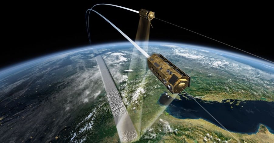
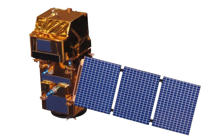
TanDEM-X

This stratospheric prospector and its twin TerraSAR-X are part of a mission to map Earth’s surface in 3D. The satellite’s data gives scientists a unique, highly accurate view of topography, especially in remote or challenging regions. It creates high-precision terrain models useful for everything from urban planning to environmental management.


