Going on a Backroad Adventure? This GPS App Will Ensure That You Won’t Get Lost
If you’re the type of adventurer that likes to spend time getting lost in nature on the weekends, then it’s important to be able to find your way. And while certain apps like Google Maps, can adequately point your car in the right direction, you’ll need something more capable when going off the beaten path.
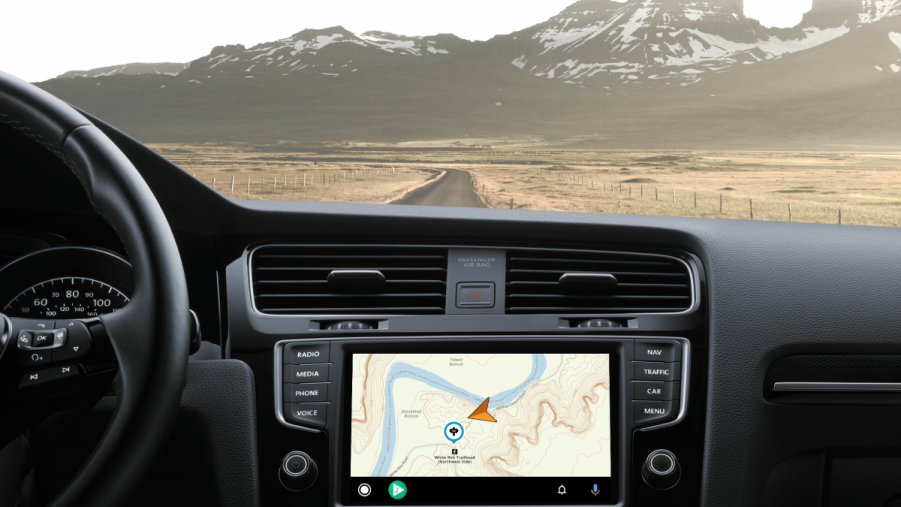
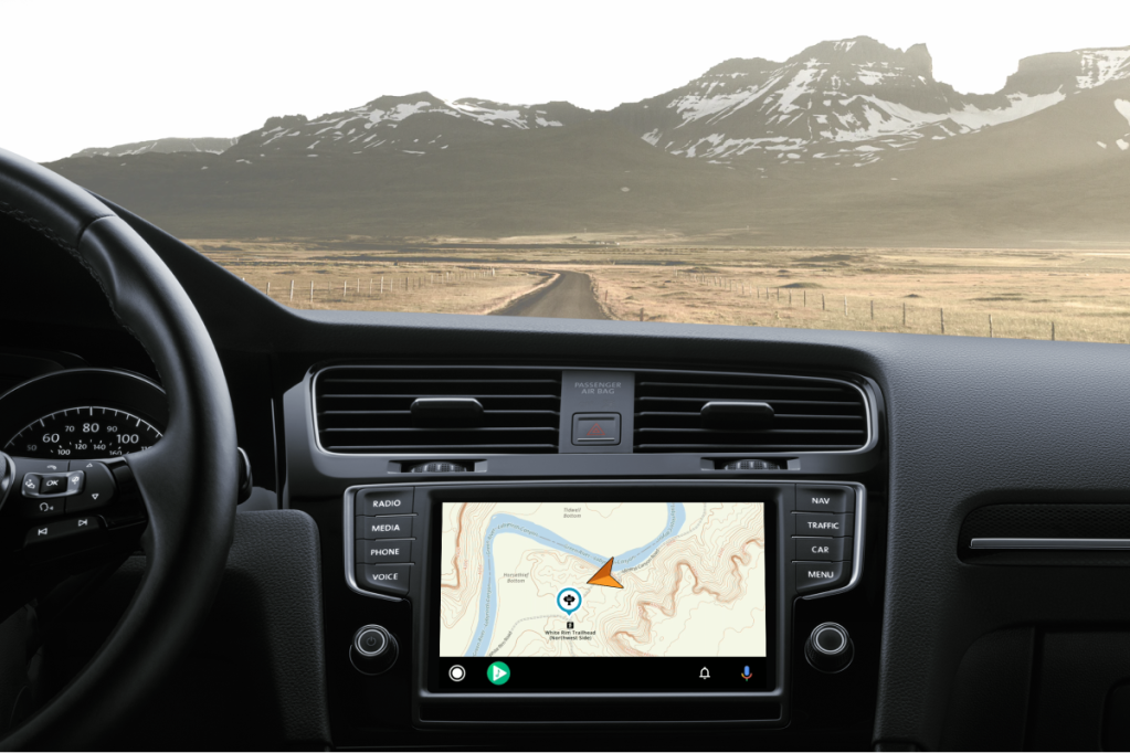
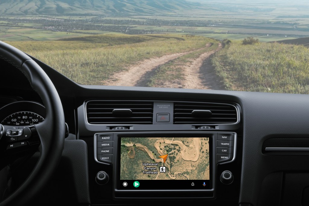
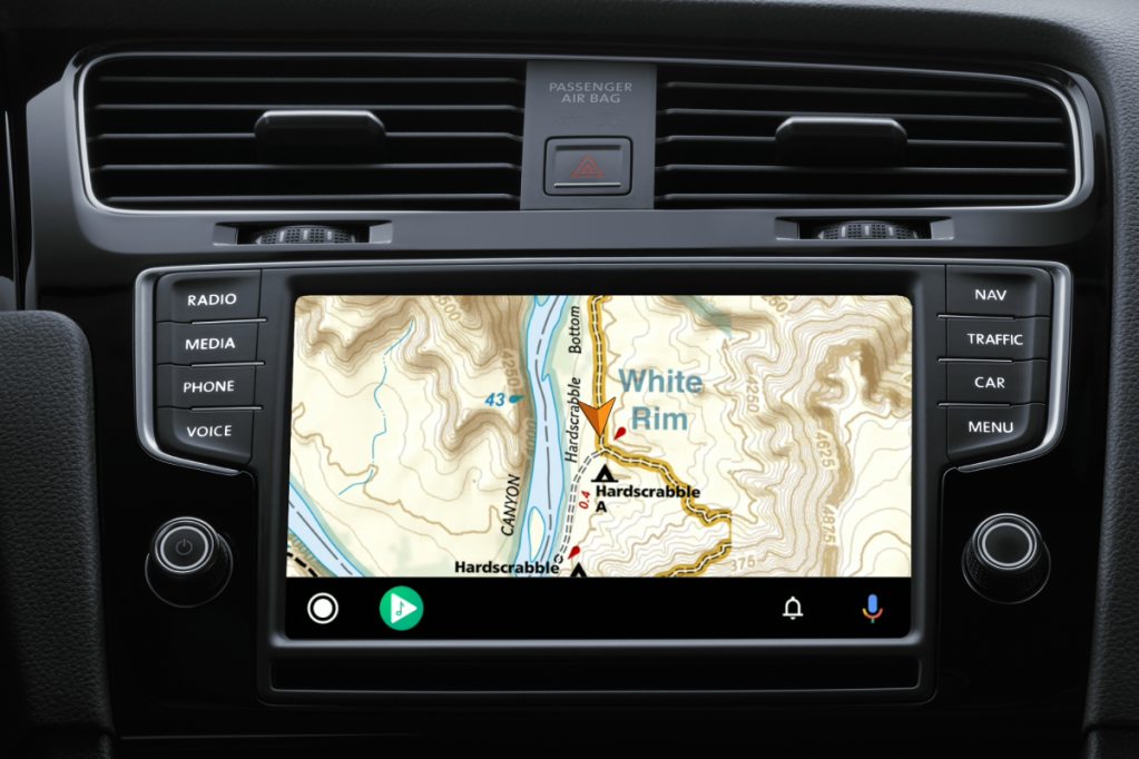
Fortunately, apps like Gaia GPS exist to help you map out back-country roads and trails with ease. And to make your life even easier, you can now use Gaia GPS on Android Auto.
What is Gaia GPS?
The Gaia GPS app is a mapping and navigation software that displays topographical and satellite maps for hikers, off-roaders, overlanders, etc. Basically, if you like to hike, mountain bike, fish, or just explore what Mother Nature has to offer, this app has everything you need to find your way. You can even overlay multiple maps and chart out points to create a whole adventure and know what’s coming on the road ahead.
The Gaia GPS goes above and beyond what Google and Apple Maps have to offer by giving the user turn-by-turn guidance on some of the most obscure backroads that they can find. With this app, you can even navigate to the trailhead of any trail and even identify landmarks and restrooms.
“The Gaia GPS development team took to the trails navigating backroads to thoroughly develop and test all of Android Auto’s new features and capabilities,” said Software Engineer and Android Auto project lead Sasha Heinen. “We can’t wait for users to do the same.”
Go off-road when you’re offline
Gaia GPS has a free version that anyone can use by signing up on the website. With the free version, users can plan maps, create routes, back up, and even share the data they find. The free version is good for the casual day trip for when you need to plot out points on a map or simply figure out which trail to hike. However, if you want more access, then you’ll need to subscribe to the premium service for $40 per year.
Aside from the ability to find mountain biking trails, backcountry ski maps, and fishing and nautical maps, premium users can also download the maps that they create. By downloading the maps, you won’t have to worry about your cell phone losing the signal. This is especially helpful now that Gaia GPS can be used on Android Auto as your car’s infotainment system can now show you the way even if your phone doesn’t have cell reception.
Is the Gaia GPS app worth the cost?
Yes, considering most handheld GPS devices for hikers can cost anywhere between $50 to $450, we would say that $40 a year is worth it. In fact, a regular paper map of certain parks and trails can cost you around $11 and that’s just for one location.
World of Waterfalls reviewed the Gaia GPS app in depth and revealed that the app served its purpose when it came to finding a hard-to-find waterfall location. They especially liked the fact that the maps can be downloaded as some handheld GPS devices have a lot of trouble getting reception in remote locations.
If you’re the type that likes to take the weekend off-road trip or perhaps go off the grid for a while, then the Gaia GPS app could be your best travel buddy. And now, it doesn’t matter if you’re using it on the trail or in your car.